Back to main page: Blossom Hill Road crossing.
The "walk" signal lures people to walk across the tracks. |
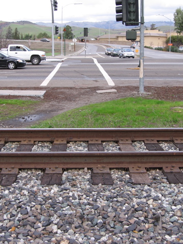
The crosswalk, view from bridge. |
There is no other destination but the path to cross the tracks. |
Walkers (shown) going directly from using the crosswalk and path to ... |
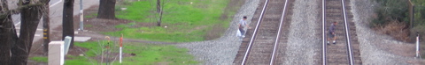
... crossing the tracks. (photo from bridge). |
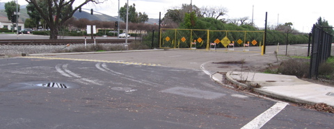
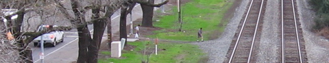
End of sidewalk from Cottle Road (seen right) is at the unofficial RR crossing, with no other continuation but the sidewalk on Monterey, across the tracks. |
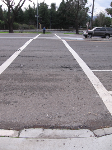
Walker just crossed train tracks. People are deceived that they should cross here. |
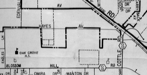
1970 map shows an at-grade railroad crossing of County Road G10 (Bossom Hill Road and Cottle Road). |
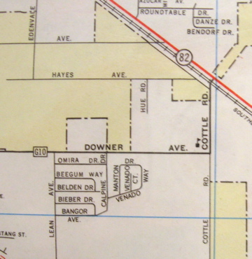
1961 map. Downer Ave. became Blossom HIll Road. Again, at-grade railroad crossing of Cottle Road is shown. |
Shoulder is safe for walkers and the parked truck. (looking west, eastbound side) |
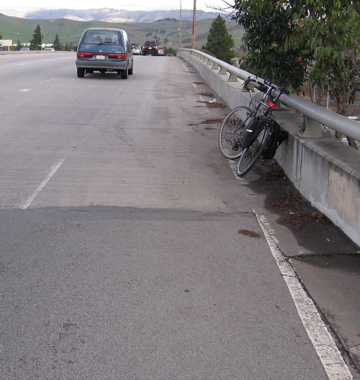
But here (top of bridge), the 8-foot shoulder was eliminated in 2003. The former shoulder line is still visible. Note bicycle. The new shoulder line is TOO NARROW for bicyclists and pedestrians. (looking east, eastbound side) |
The 8-foot shoulder (shown with bicycle) reappears at other end of the bridge. (SE side) |
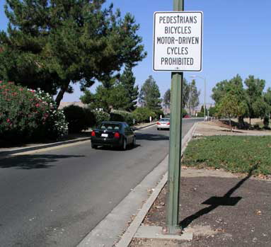
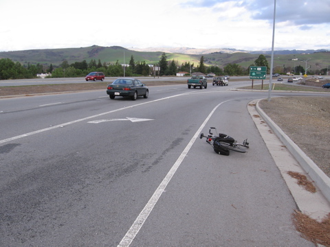
Posting "Pedestrians Bicycles ... Prohibited" is San Jose DOT's solution to the "pedestrian problem" but is illegal under CVC 21960 because Blossom Hill Road is not a freeway. (NE side) |
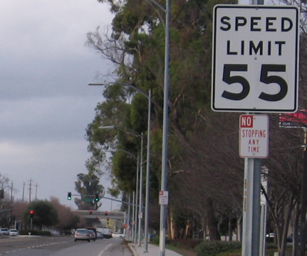
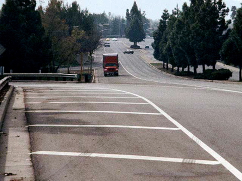
55 MPH for Monterey Highway. Blossom Hill bridge is in background. |
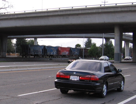
Freight train and car traffic. Grade separations are the safest form of crossing, bar none. (photo: Blossom Hill bridge, looking N) |
![McDonalds, destination of Katrina Hatton with bridge in background. [End slideshow 1].](crossing-Thumbnails/15.jpg)
McDonalds, destination of Katrina Hatton with bridge in background. |